Cogimator – A Curated Directory of Unique Websites#
Cogimator.net is a carefully curated directory of websites that offer something more than just sleek design or trending buzz. It’s a collection of digital places created with passion — independent projects, experiments, and archives that challenge how we experience the web.
We don’t chase popularity. Instead, Cogimator focuses on originality, usefulness, creativity, and cognitive depth. You’ll find websites that are often overlooked by mainstream platforms — projects made by individuals, small teams, or devoted communities.
In short, it’s a curated directory of unique websites — assembled by hand, driven by curiosity.
We feature:
educational tools and visual simulations
cultural curiosities and digital micro-archives
experimental interfaces and interactive essays
artistic expressions and personal knowledge libraries
web-native projects that defy classification
Our mission is to:
support independent creators and timeless ideas
promote alternative knowledge sources
encourage slow exploration and digital curiosity
Most featured sites are:
non-commercial or ad-free
niche but high quality
thoughtfully crafted and often hand-coded
alive for years, yet virtually invisible to the average user
We believe in an internet that surprises, teaches, and inspires — a web that resists homogenization. If you’re tired of algorithms, top-10 lists, and over-optimized content, you’re in the right place.
Nautilus stands out in the crowded landscape of science publications by treating scientific discovery as storytelling. Rather than simply reporting research findings, this digital magazine weaves together astronomy, evolution, psychology, philosophy, and other disciplines into narratives that reveal the deeper connections between scientific knowledge and human experience.
The publication’s approach is distinctly literary, with articles that read more like carefully crafted essays than typical science journalism. Recent pieces explore everything from the behavioral patterns of ancient Neanderthals to the psychology behind academic fraud, always with an eye toward broader implications. The writing consistently maintains intellectual rigor while remaining accessible to curious readers outside academia.
...
Sloww: Slow Living Philosophy & Mindful Development
Sloww represents a refreshing countermovement to our accelerated digital age, offering a comprehensive framework for intentional living and spiritual development. Created by Kyle Kowalski, this platform structures personal growth into four distinct stages: Intentional Living (designing a lighter life), Life Purpose (finding higher meaning), Mental Mastery (building a better mind), and Spiritual Seeing (transcending mental limitations).
The site’s approach is both systematic and deeply philosophical, drawing from diverse wisdom traditions while maintaining practical applicability. Rather than quick fixes or productivity hacks, Sloww emphasizes sustainable transformation through what they call “downshifting into deeper living.” The content spans from lifestyle design and voluntary simplicity to advanced spiritual concepts like nonduality, creating a bridge between practical life optimization and profound existential inquiry.
...
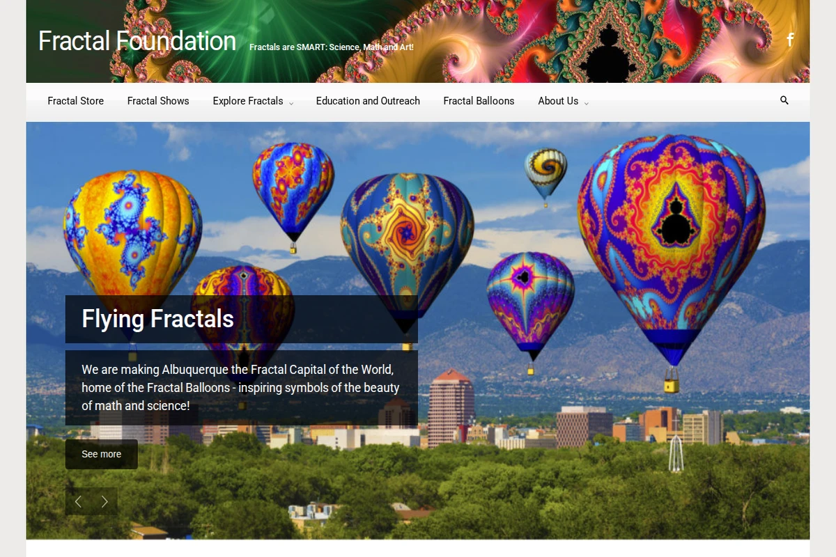
Fractal Foundation: Science, Math and Art Education
The Fractal Foundation has set itself an ambitious goal: making Albuquerque the fractal capital of the world. This unique organization bridges the gap between abstract mathematics and tangible beauty through their innovative educational programs and spectacular public displays. At the heart of their mission are the famous Flying Fractals — hot air balloons adorned with intricate fractal designs that soar above the city during the annual Balloon Fiesta.
The foundation’s educational impact extends far beyond their eye-catching aerial displays. Their Albuquerque Fractal Challenge invites local students to explore fractal mathematics through creative design, with winning artworks enlarged and displayed as massive public art installations throughout the city. The organization offers professional development programs for teachers, fractal workshops at venues like Meow Wolf, and regularly hosts public shows that demonstrate how simple repetitive processes create the complexity and beauty we see in nature.
...
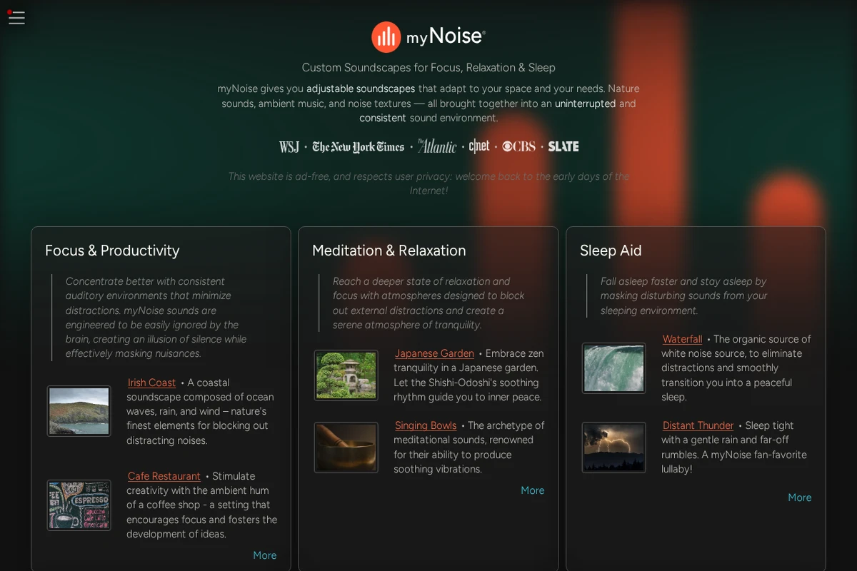
myNoise - Customizable Soundscapes for Focus & Sleep
myNoise represents a refreshing return to the early web’s principles: no ads, no tracking, just pure functionality delivered with remarkable sophistication. This platform transforms ambient sound into a precise tool for mental well-being, offering adjustable soundscapes that adapt to your environment and psychological needs.
What sets myNoise apart is its engineering approach to audio masking. Rather than simple loops, these sounds are designed to be easily ignored by the brain while effectively masking distractions. The platform covers an impressive range of use cases, from ADHD support and tinnitus relief to creating the perfect coffee shop ambiance for productivity. Each soundscape can be fine-tuned with spectral controls, allowing you to shape everything from synthetic white noise to natural rain sounds.
...
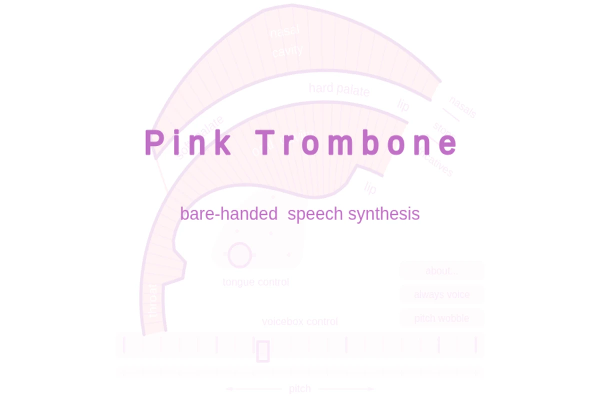
Pink Trombone represents a remarkable fusion of anatomy, acoustics, and interactive design. This browser-based speech synthesizer models the human vocal tract with stunning accuracy, allowing users to manipulate every component involved in speech production — from the position of the tongue and lips to the opening of the vocal cords.
What sets this tool apart is its intuitive, hands-on approach to understanding phonetics. Rather than working with abstract parameters or phoneme databases, you directly shape sounds by dragging and positioning anatomical elements on screen. The real-time audio feedback creates an almost magical experience as you discover how subtle changes in tongue position can transform vowels, or how constricting airflow produces different consonants.
...
The Zoomquilt stands as one of the internet’s most mesmerizing early digital art experiments, creating an infinite zoom experience that feels both hypnotic and profoundly collaborative. Born in 2004 from the vision of Nikolaus Baumgarten, this project emerged from the early 2000s scene of collaborative online art-making, where artists would contribute individual tiles to evolving patchwork paintings in a process reminiscent of the surrealist drawing game Cadavre Exquis.
The magic lies in its seamless construction: fourteen illustrators each contributed segments that had to blend perfectly with their neighbors’ work, creating visual transitions that flow from one artist’s imagination to another’s. As you navigate with simple up and down arrow keys, you’re taken on a journey through interconnected worlds that range from mechanical and industrial to organic and fantastical. The animation creates the illusion of endless depth, where each zoom level reveals new details and artistic interpretations while maintaining perfect visual continuity.
...
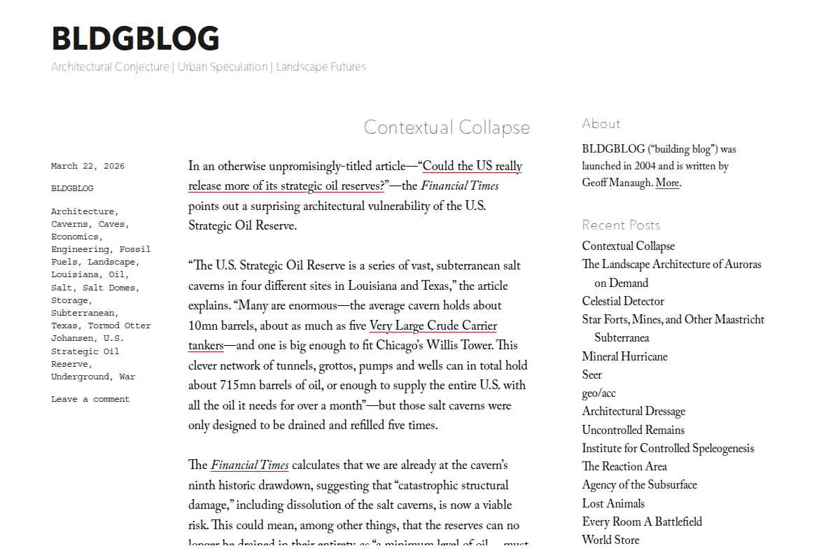
BLDGBLOG has been one of the most distinctive voices in architectural discourse since 2004, when Geoff Manaugh launched this singular platform for “Architectural Conjecture, Urban Speculation, and Landscape Futures.” What sets BLDGBLOG apart is its ability to find architectural significance in the most unexpected places, from underground oil reserves to artificial aurora experiments.
The blog’s recent post on “Contextual Collapse” exemplifies this approach perfectly. Manaugh takes a Financial Times article about strategic oil reserves and transforms it into a meditation on architectural vulnerability and subterranean infrastructure. The U.S. Strategic Oil Reserve becomes not just a utilitarian storage system, but a vast underground architecture of salt caverns that could someday simply collapse under their own geological limitations.
...
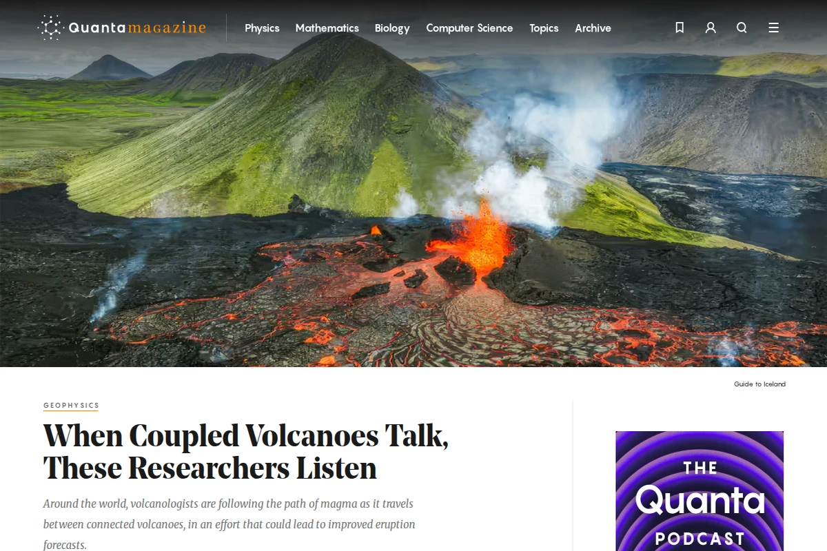
Quanta Magazine stands as one of the most respected names in science journalism, delivering sophisticated yet accessible coverage of cutting-edge research across physics, mathematics, biology, and computer science. Published by the Simons Foundation, this digital publication has built a reputation for taking the time to properly contextualize complex scientific discoveries rather than chasing daily news cycles.
What sets Quanta apart is its commitment to deep, narrative-driven reporting that helps readers understand not just what scientists have discovered, but why it matters and how it fits into the broader landscape of human knowledge. Whether exploring the latest developments in string theory, the mathematics behind bell curves, or the mechanics of volcanic eruptions, the magazine consistently produces articles that respect both the complexity of the subject matter and the intelligence of the reader.
...
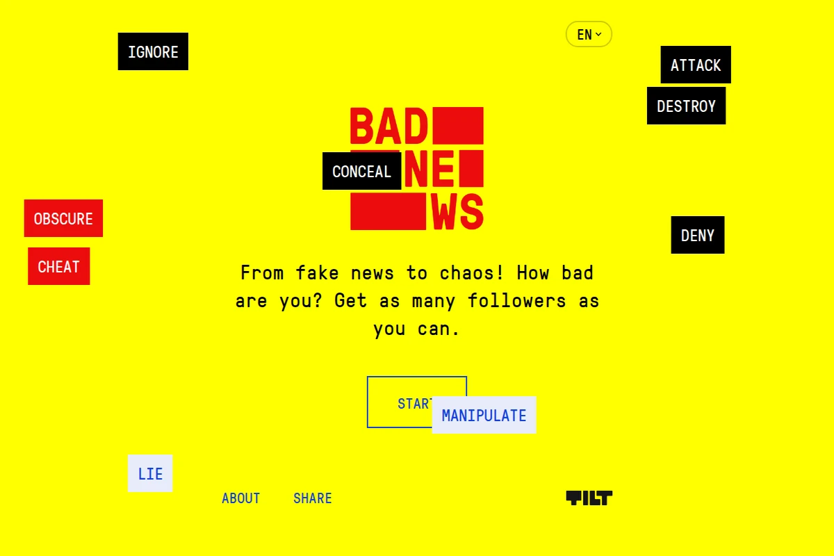
Bad News presents a fascinating paradox: to understand how misinformation works, you must first learn to create it. This interactive game puts players in the role of a fake news producer, challenging them to build a following through manipulation, lies, and conspiracy theories.
Developed as an educational tool for media literacy, the game reveals the psychological mechanisms behind viral misinformation. Players navigate through scenarios involving polarization, emotional manipulation, and the exploitation of confirmation bias. The experience is both unsettling and enlightening as you discover how easily public opinion can be swayed through strategic deception.
...
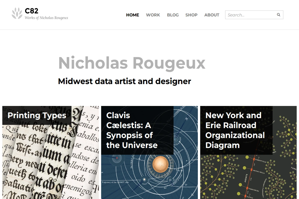
C82: Nicholas Rougeux's Data Art & Historical Recreations
Nicholas Rougeux has carved out a fascinating niche at the intersection of data visualization and historical preservation. This Midwest-based artist specializes in creating meticulous digital recreations of vintage scientific illustrations, organizational charts, and educational materials that might otherwise be forgotten to time.
His portfolio showcases an impressive range of projects, from the intricate astronomical diagrams of Thomas Wright’s 1742 Clavis Cælestis to the elaborate typography specimens in Daniel Updike’s printing guide. Each project represents months of painstaking research and reconstruction work. Rougeux doesn’t simply scan or photograph these historical documents—he rebuilds them from scratch, often spending considerable time hunting down source materials and understanding their original context.
...