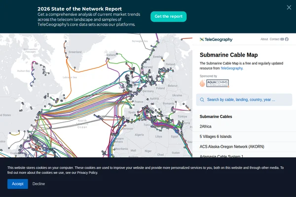
The internet may feel ethereal, but its physical foundation runs along the ocean floor in the form of hundreds of submarine cables. TeleGeography’s Submarine Cable Map reveals the hidden infrastructure that makes global communication possible, showing how fiber-optic cables snake across ocean basins to connect continents.
This meticulously maintained resource tracks active, planned, and retired submarine cables worldwide. Each colorful line represents a crucial piece of internet infrastructure, from major trans-Atlantic routes like Dunant and Grace Hopper to regional systems connecting island nations. The interactive interface allows users to search by cable name, landing point, or country, revealing technical details about capacity, length, and operational status.
What makes this map particularly fascinating is how it exposes the physical reality behind our digital world. Nearly 99% of international internet traffic flows through these underwater highways, making them more critical to global connectivity than satellites. The visualization also highlights geopolitical aspects of internet infrastructure, showing how cable routes reflect economic partnerships and strategic relationships between nations.
Maintained by telecommunications research firm TeleGeography and regularly updated with new deployments and repairs, this free resource serves network engineers, policy researchers, and anyone curious about the cables that keep the world connected.