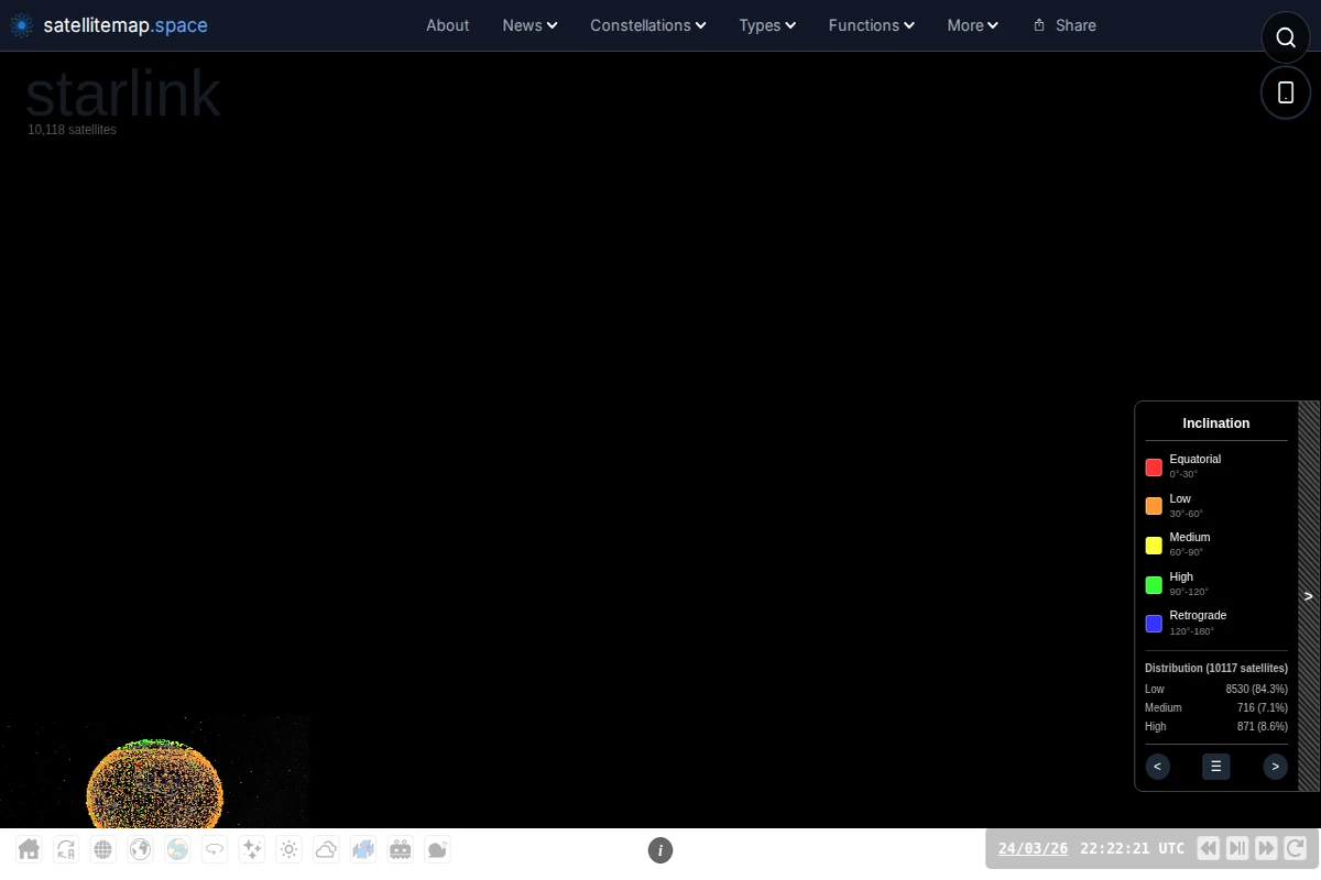
Live 3D Satellite Map - Track 10,000+ Satellites in Real Time
Satellitemap.space transforms the invisible infrastructure of our connected world into a stunning real-time visualization. This sophisticated web application tracks over 10,000 active satellites orbiting Earth, rendering them as a living constellation against a backdrop of high-resolution star fields and realistic Earth imagery sourced from NASA’s Blue Marble dataset. The technical achievement here is remarkable — the platform combines WebGL rendering with precise orbital mechanics calculations using SGP4/SDP4 algorithms to display satellite positions with scientific accuracy. Users can explore different satellite constellations including Starlink, filter by orbital inclination, and access detailed information about each spacecraft. The interface includes real-time cloud imagery, ground station locations, and even shows the distribution of satellites across different orbital planes. ...